


Scientists are using the same type of lasers that are used in self-driving cars to track the massive meltdown of this winter's record snow in the West.
The stakes are high in California. This winter was like no other. Some areas received over 50 feet of snow.
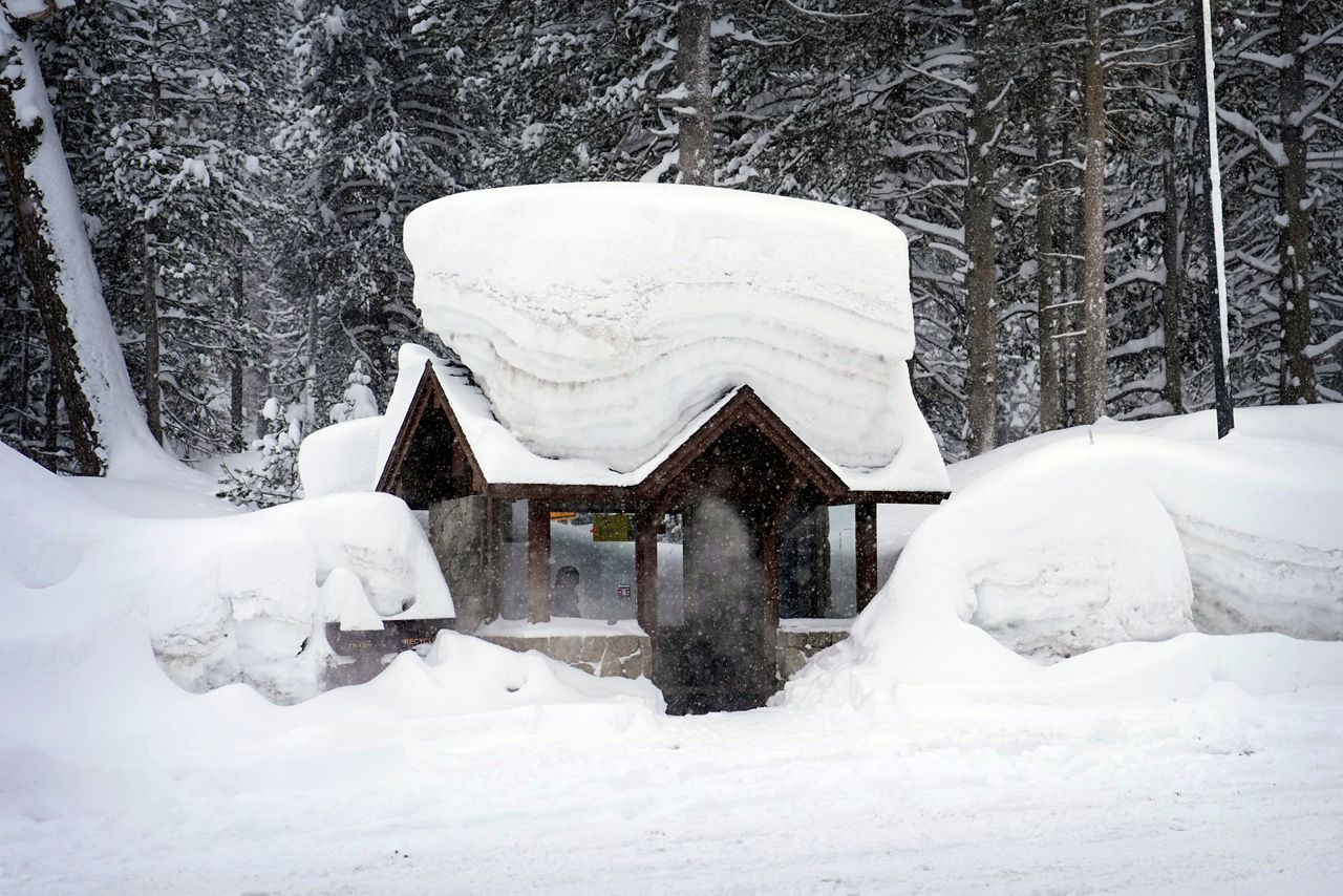
This has brought much-needed drought relief, but as spring temperatures take hold, there are worries about destructive flooding.
Also, resource managers are busy calculating how much water to release from reservoirs and dams. Every drop is precious, so they don't want to waste this water, but they also need to be ready for the big melt that's coming.
The big question is how much snow is in the mountains and how much water will it create when it melts?
Historically, measuring the snow and water content of the snowpack has been done by hand. Scientists trek to the mountains and take core measurements of the snow.
This is done by taking a long tube that can be up to 20 feet long and drilling it down into the snow and then removing it, extracting a core of snow and ice. They then measure the weight of that core of snow and ice to determine the water content.
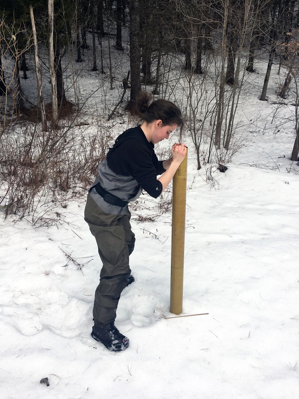
This process is labor intensive, exposes the researchers to avalanche dangers and can only cover a small portion of the snowpack.
This process is still used, but there are newer methods.
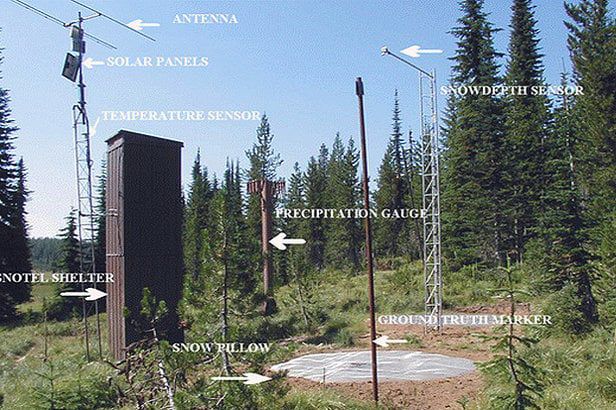
One is the SNOTEL network. These are automated weather stations that measure how much snow there is and how much water is in that snow. There are more than 700 of these units spread across the mountains of the West.
The key component of the station is a bladder filled with antifreeze.
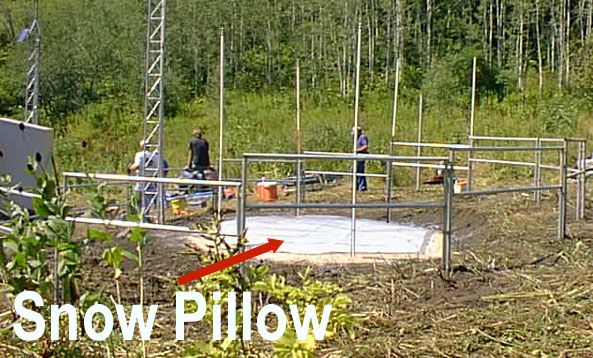
As snow falls on this bladder, antifreeze expels into a measurement tube, allowing scientists to determine the weight of the snow.
Data from these stations are transmitted via radio waves.
This is better than the manual method, but this process still only shows data for a small portion of the snowpack.
One day, scientists hope to measure the snow from space using satellites.
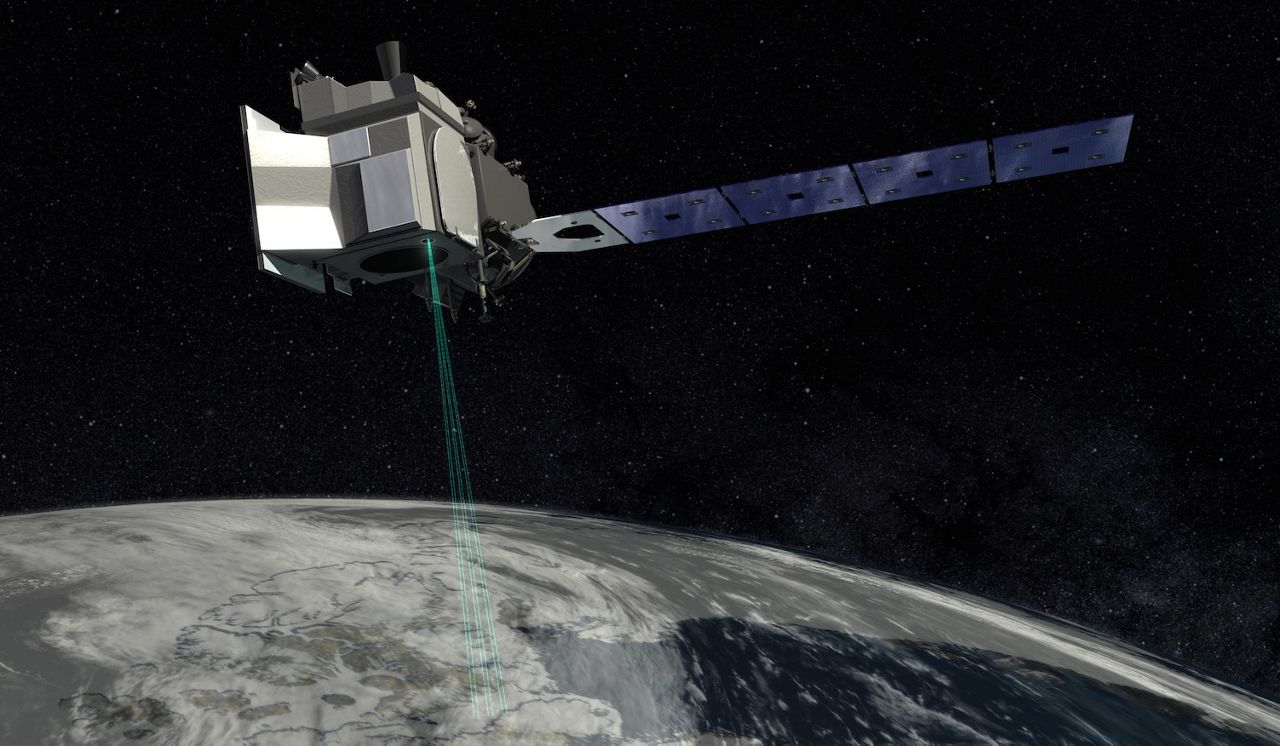
NASA has a test project underway, but so far, it's only in the early stages.
The current best way to measure snow depth and water content over a wide area is the Airborne Snow Observatory.
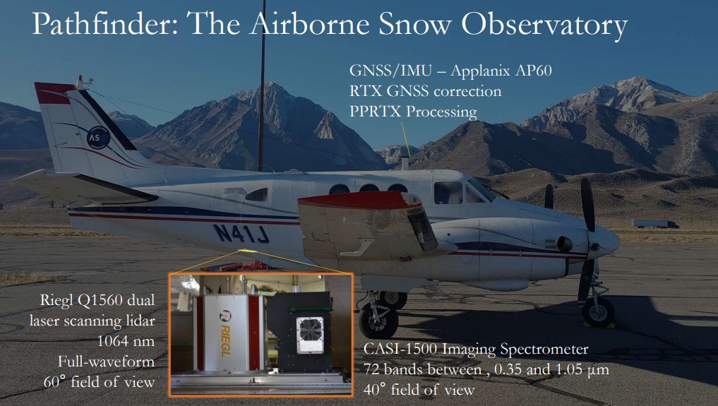
These are airplanes outfitted with scanning Lidar. This is a laser, pulses of light, and stands for Light Detection and Ranging.
It creates a three-dimensional map of the snow and ice and can measure snow depth to within an accuracy of less than three inches. It's the same technology that self-driving cars rely on to create a three-dimensional map of the road and surrounding area.
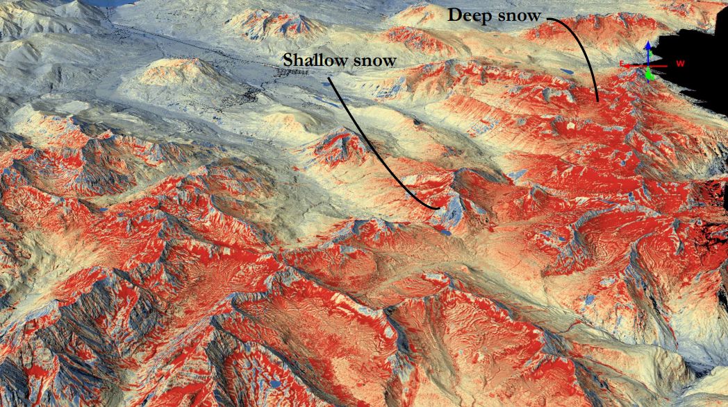
Also, onboard is an imaging spectrometer. This measures the albedo or reflectivity of the snow. This helps researchers estimate how fast the snow will melt.
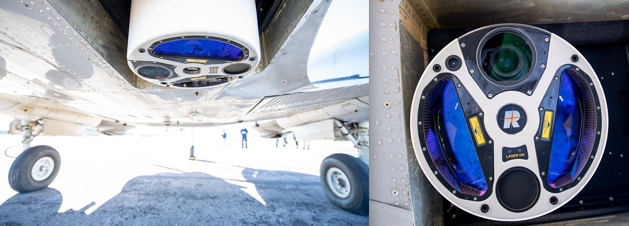
Each flight of these flying laboratories can cover up to 40,000 square miles.
Generally, there are two to three people onboard these flights, which can last three to four hours. The staff onboard both fly the plane and operate the instruments, which provide the data in near real time.
The airborne snow observatory will be relied upon this spring to measure the snow and water content for California and much of the West.
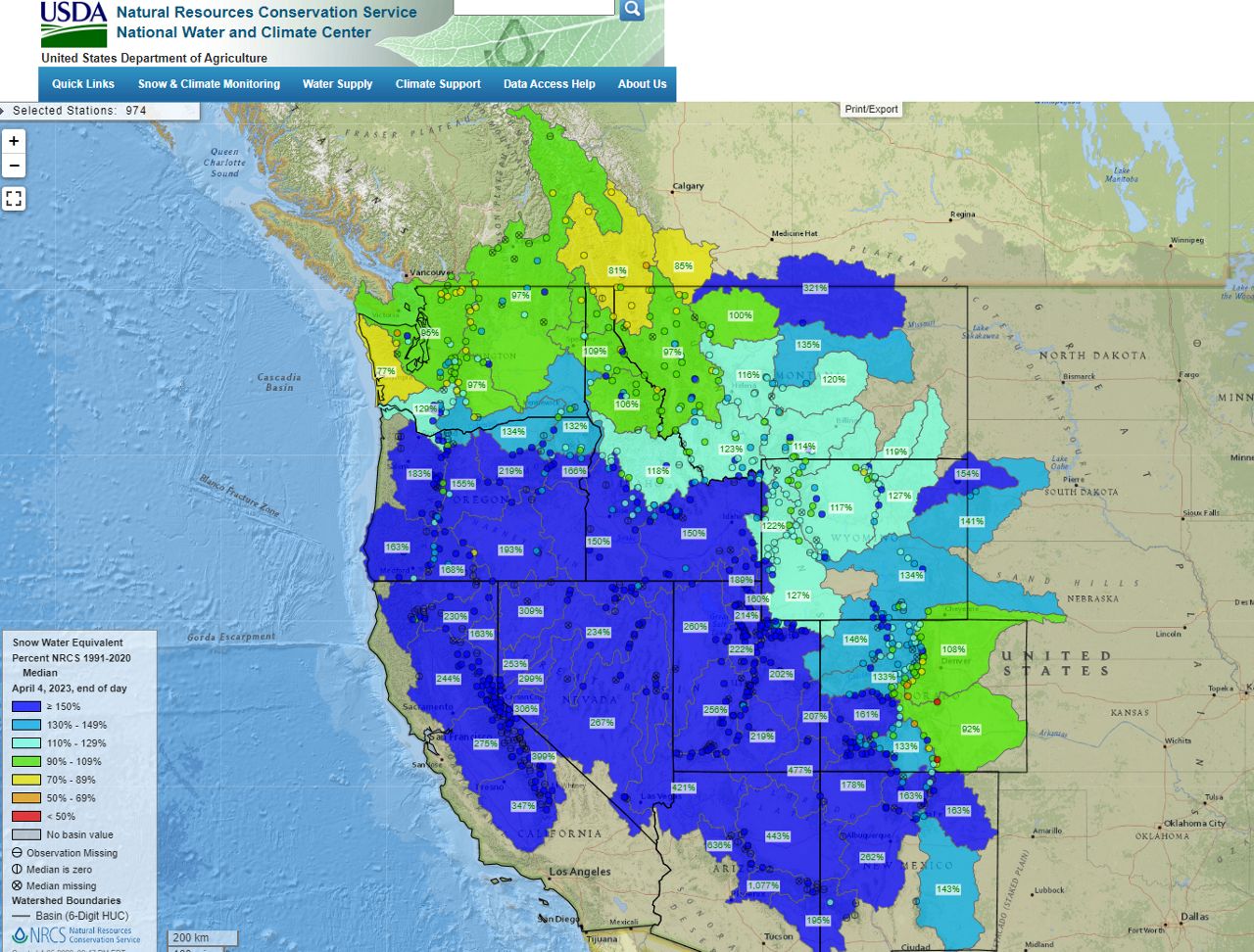
NOAA figures show that 85% of the freshwater in the Western states comes from the snow melt.
Also, scientists will use the data to make key decisions as cities and towns prepare for what is expected to be serious flooding this spring.
Our team of meteorologists dives deep into the science of weather and breaks down timely weather data and information. To view more weather and climate stories, check out our weather blogs section.