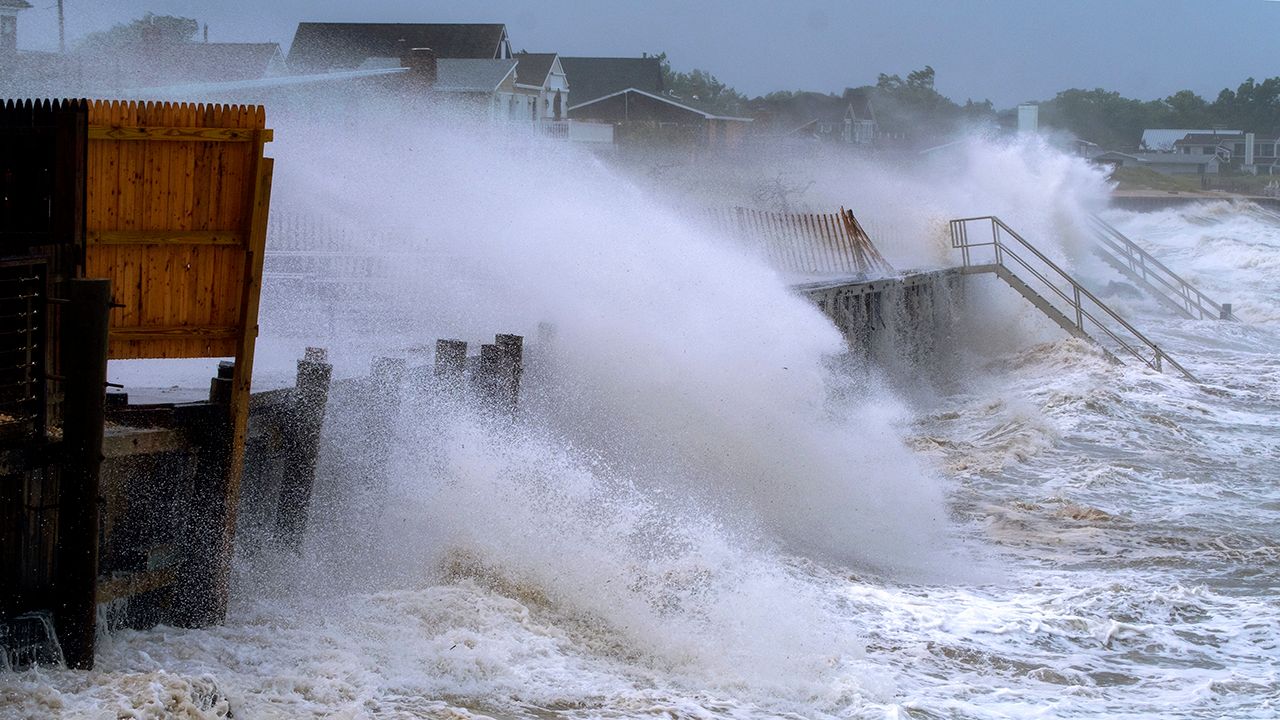
New Yorkers got to practice their French accent when Henri brought flash flooding and gusty winds to the city. The storm broke some rainfall records, but it was also an unusual storm for other reasons.
First of all, why Henri (pronounced ahn-REE) and not Henry? Who decided that? That's the question I got asked over and over.
Well, the World Meteorological Organization (WMO) determines the name and pronunciation.
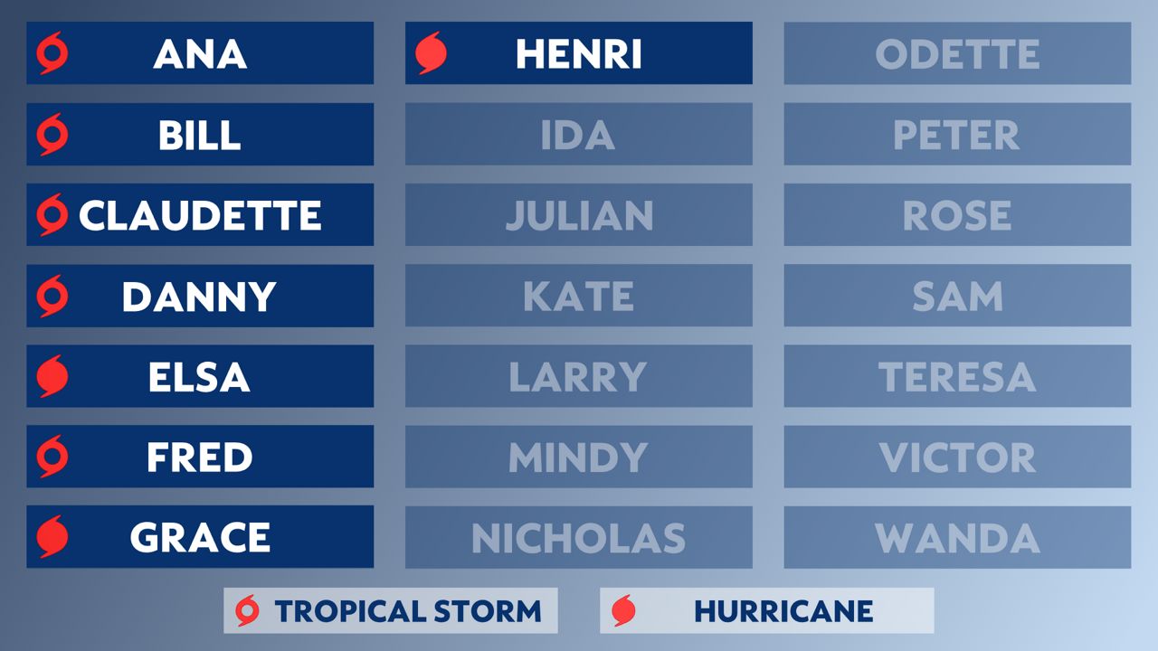
There are six lists of names that alternate between male and female names, in alphabetical order. When a storm causes a lot of damage or makes history, the WMO votes to retire its name and replaces it with a new one.
For example, there will never be another Andrew, Katrina or Sandy.
Many tropical systems in August originate from clusters of thunderstorms that come off the coast of Africa and travel across the ocean, but Henri was unique.
Instead, Henri came from a cluster of thunderstorms that developed in the middle of the United States and traveled across the Northeast and eventually into the Atlantic.
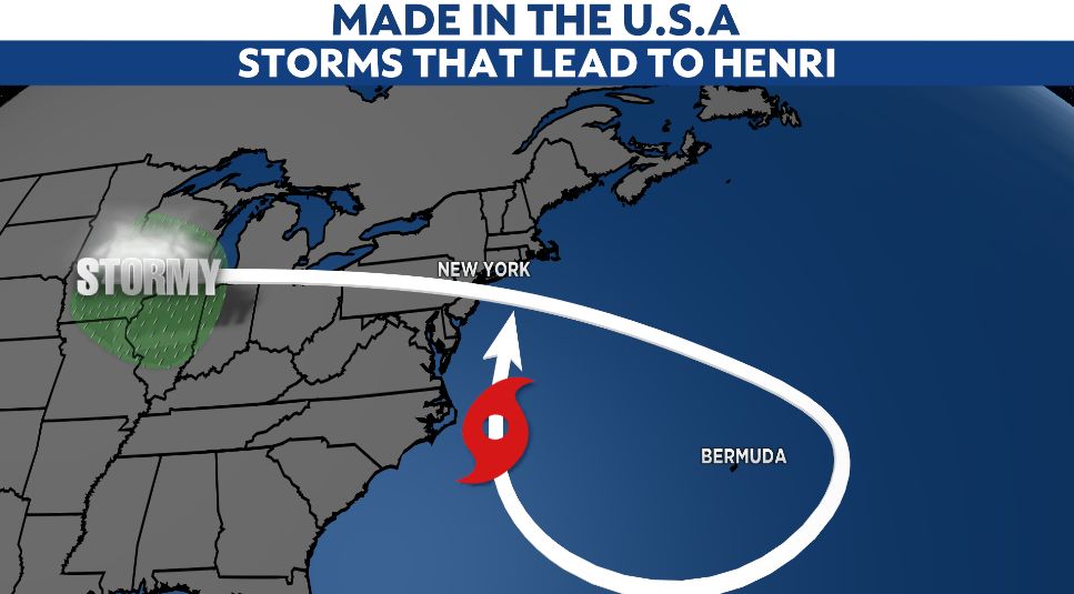
These storms developed into Henri, and given the circulation, the storm looped around Bermuda and came back toward the East Coast of the United States.
So, one could argue that the same disturbance brought rain to the city twice, about 10 days apart.
That's right. As explained earlier, there are six lists of names used to name tropical systems. So, if a name isn't retired, it'll appear again in six years.
In September 1985, there was a Henri, and it has one pretty amazing similarity to this year's Henri.
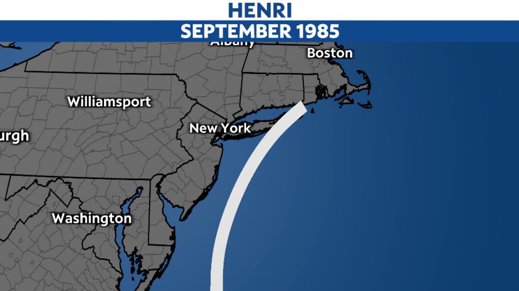
Thirty-six years ago, Tropical Storm Henri traveled along the East Coast and made landfall in our nation's smallest state, Rhode Island.
Well, fast forward to 2021, six name cycles later, another Tropical Storm Henri made landfall on our nation's smallest state.
What are the chances?! Apparently, better than most of us would've assumed.
I'm not sure you'd call it the Perfect Storm, but Henri was indeed two storms that became one. This largely contributed to the massive rain totals across New Jersey and New York City.
The tropical part of the storm developed past Bermuda and was clearly tropical, meaning it had origins with a warm and moist center.
The second part of the storm was a dip, or trough, in the jet stream that moved across the Great Lakes at the same time Henri developed. The center of the trough is an upper-level low pressure system.
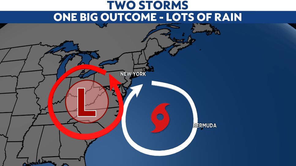
The circulation between this low and Henri created a river of moisture into the Tri-State region, which led to a round of flash flooding while the center of Henri was still hundreds of miles away.
More rain followed as the center of Henri pushed into the Northeast in the days that followed.
Henri broke a few different records, but with that extra push, some of the seasonal stats are now impressive as well.
The rain that arrived ahead of the center of Henri broke a record in Central Park for the wettest hour on record. About 1.92 inches of rain fell between 10 p.m. and 11 p.m. on Saturday, Aug. 21.
The daily rainfall record also broke on Aug. 21 and 22, which led to a rainfall total of over 8 inches at Central Park for the entire event. Parts of Brooklyn saw almost 10 inches.
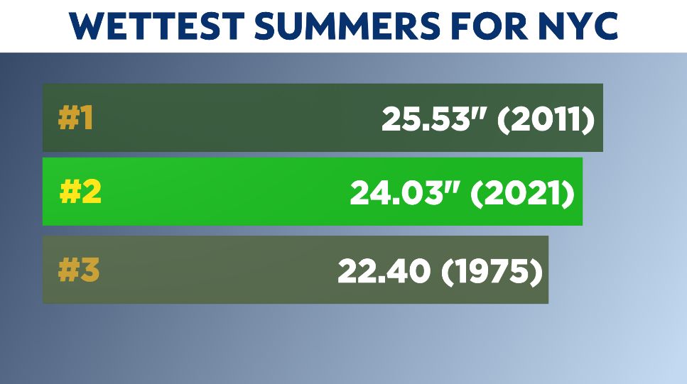
Remember, this past July was the third-wettest on record. After Henri, August is now the fourth-wettest on record. Add all of that up, and this summer (since June 1) is now the second-wettest summer on record.