


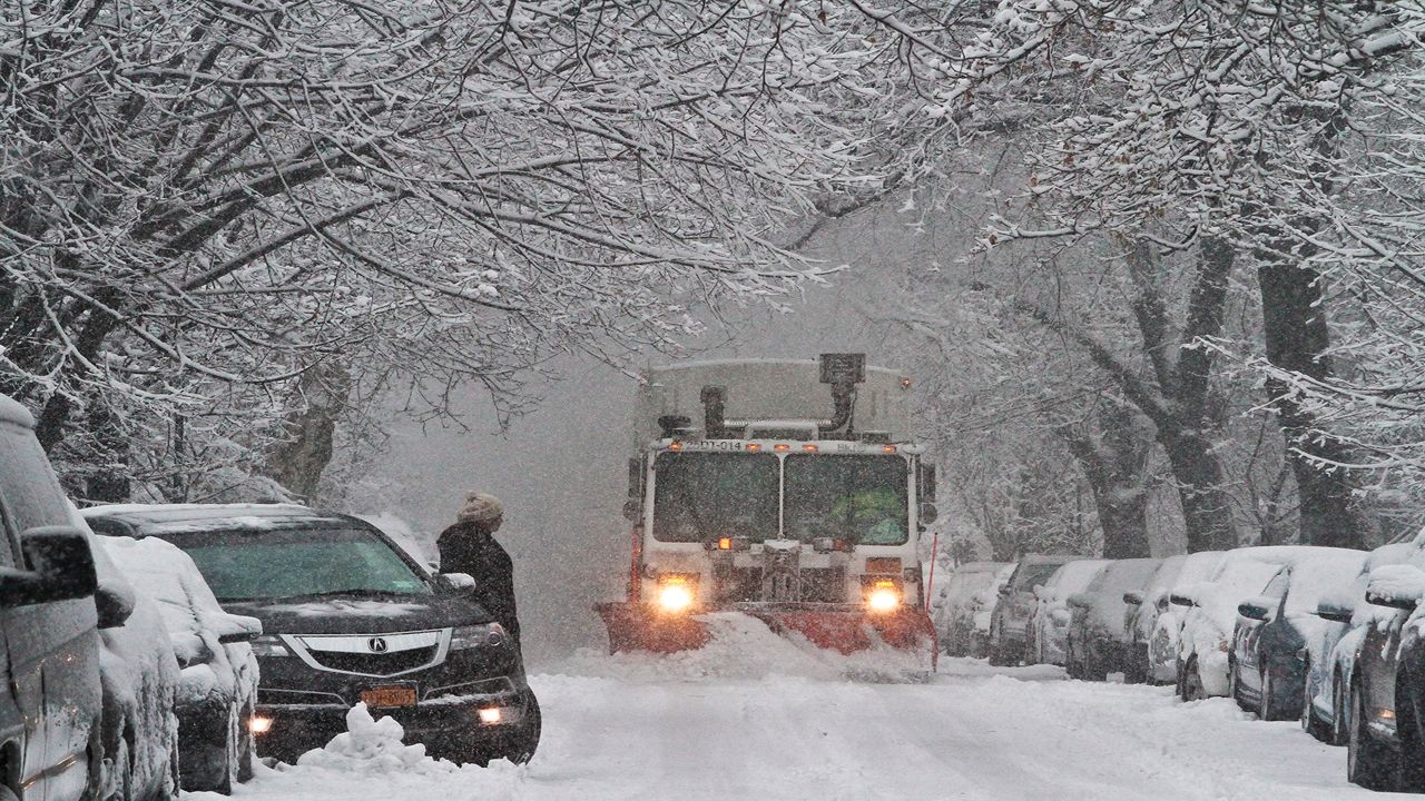
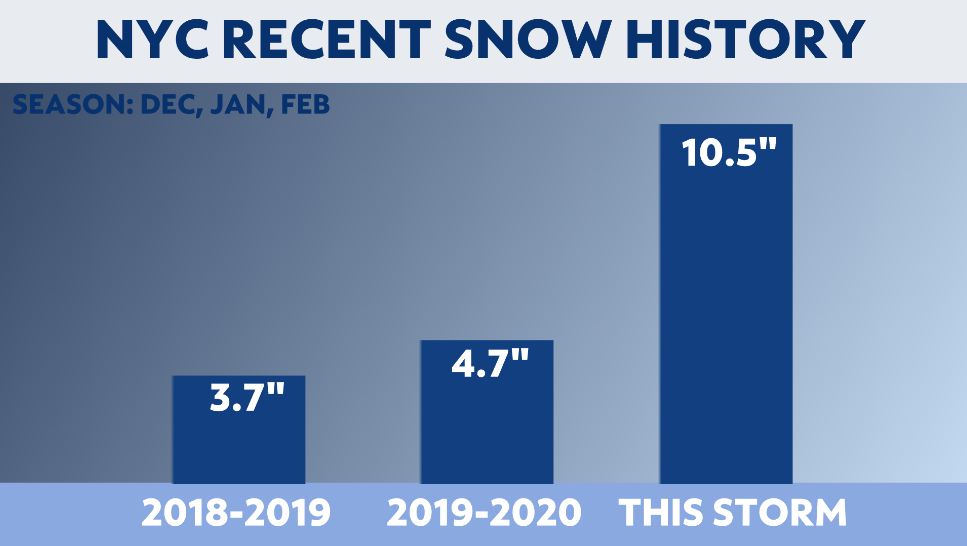
A nor'easter brought officially 10.5 inches of snow to New York's Central Park from late Wednesday into Thursday, which was more snow than the previous two snow seasons combined.
The storm that made the city into a holiday wonderland was a classic nor'easter. The low developed in a weather pattern that favors coastal low pressure systems.
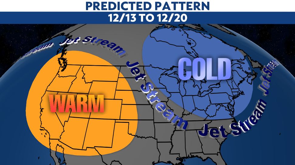
A week before the storm developed, our Meteorologists at NY1 knew to be on the lookout. With a dip in the jet stream, also known as a trough, the scene was set for coastal storms to develop.
Sure enough, a storm did develop. With the cold air already in place, the storm moved up the east coast. By Thursday morning, we had a classic nor'easter producing widespread heavy snow.
You might be asking yourself, so what makes it a nor'easter? It gets its name from the wind direction that this type of storm produces. With the circulation around a storm being counter-clockwise, the wind with a nor'easter is from the northeast.

Measurements around the city from this nor'easter ranged from about 6 inches to a foot.
The official measurement at Central Park, where weather records for the city are kept, was more than the city saw in both the winter of 2019-2020 and 2018-2019.
I want to get into the forecasting of a big snowstorm. We've published a few blogs about the difficulties of forecasting snow before, and this storm wasn't any different.
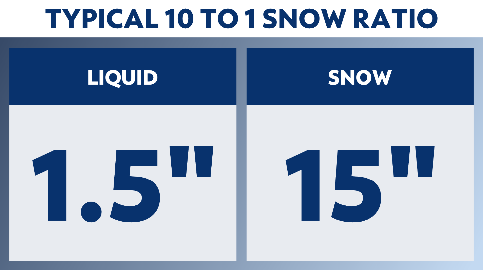
Our forecast models indicated that about 1.5 inches of liquid equivalent would fall from the sky. In standard practice, we use a 10:1 ratio when forecasting snow. So, 1.5 inches of liquid would mean about 15 inches of snow.
We know that in early December, the Atlantic Ocean has a surface temperature around 50 degrees. Since NYC is a coastal city, it is easy for snow to mix with sleet or even rain. So, keeping that in mind, our forecast was for 8 to 14 inches of snow.
In the end, this forecast generally verified well. Those near the Atlantic Ocean saw the low end of the forecast range. Those away from the ocean saw nearly a foot of snow.
As we expected, the snow to liquid ratio didn't quite reach that 10:1 benchmark. The actual ratio was closer to 7:1. Later in the winter, as the ocean cools more and the air ahead of a storm gets colder, our ratios can exceed 10:1.

Here's an example of a place where the ratio was higher. From this same storm, Binghamton, NY reported a liquid measurement of 2.80 inches. The amount of snow measured from the storm was over 40 inches. That's a ratio of nearly 15:1.
These ratios in cold and dry climates can reach 20:1 or even 40:1.
The snow with ratios this high will be much drier and therefore very fluffy and light. It is quite the opposite of the heavy and wet snow we see in New York City.

If NYC saw a ratio of 20:1 with the liquid reported at Central Park from this storm, the snow on the ground would've measured 30 inches!