


It’s hard sometimes for the general public to understand the severe weather risks that could be faced on any given day.
On Aug. 27, much of Southeast and Upstate New York were under an enhanced risk for severe weather, with Tornado Watches in effect.
We’ll talk about what that means to be under an enhanced risk in a moment. I had a conflict with a family member that day where I tried to warn them, but they didn’t seem to think there was anything to worry about.
I’m not writing this to rank on a member of my family, of course. This is a very common issue. My colleagues and I have degrees in meteorology, but we can’t expect someone without a degree to have the same understanding of how severe weather works.
For context, the Storm Prediction Center (SPC) through the National Weather Service is responsible for the daily convective outlooks that are issued for the United States. Think of severe weather risk on a scale of 1 to 5, like this:
Most of the time in the summer, when there is a risk for severe weather, the SPC puts areas in New York under the marginal or slight category. That would mean most of the time, we find the severe weather risk to be 1 out of 5, or 2 out of 5, respectively.
On the day I tried to warn my family member, I was home with my family in Westchester County. We were under an enhanced risk for severe weather (3 out of 5), which happens infrequently in our part of the country.
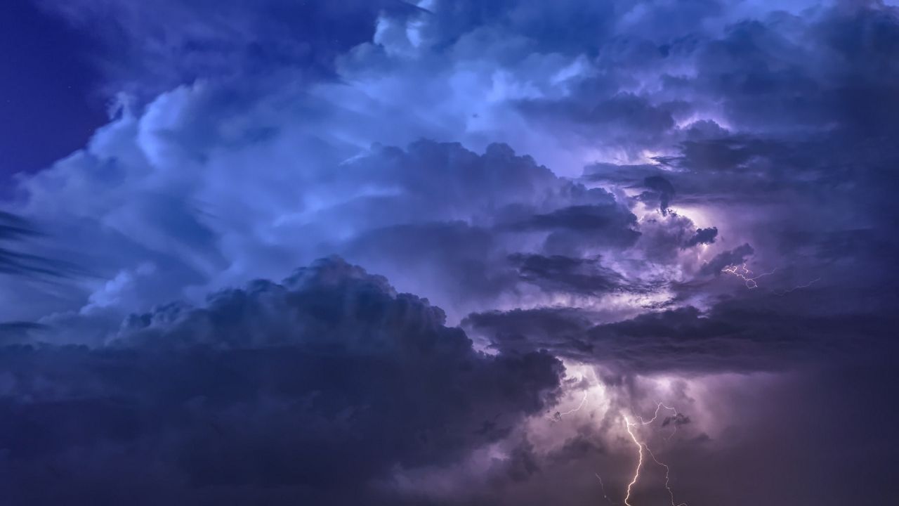
An enhanced risk is issued when there is reason to believe that there will be persistent and widespread thunderstorms, with a few of them potentially being intense. This includes the threat of a couple tornadoes.
After advising my family member of the risk, I was told that it looks sunny so it should be fine. This is a big and typical misconception.
The days with the most sun, heat, and humidity are the days where severe weather is most likely - especially if a front is passing through. On Aug. 27, all the ingredients were there.
Soon enough, storms broke out and Severe Thunderstorm Warnings were issued. Remember, a warning means that the weather threat is either imminent or occurring.
However, despite being under a Tornado watch and Severe Thunderstorm Warning, all we experienced was heavy rain and some lightning. We found no hail, no wind, and certainly no tornado. My family member then commented that all it did was rain, implying that I overreacted.
Meanwhile, a tornado-producing thunderstorm passed through Orange County not too far away, and an EF1 tornado was confirmed in Montgomery, NY the next day. Straight line winds created tree and structural damage, with an 82 mph wind gust measured. Orange County was under the same enhanced category as we were in Westchester County, and the experience there was vastly different.
The takeaway from this is simple.
Severe weather should always be taken seriously. Meteorology is an ever-growing science, and our weather models aren’t yet accurate enough to pinpoint specifically what will happen in your town.
While a whole region may have the perfect setup for severe weather, it’s not yet possible to predict the specific “dot on the map” location where severe weather/a tornado could occur.
You can get more information on severe weather any time from the Storm Prediction Center.