


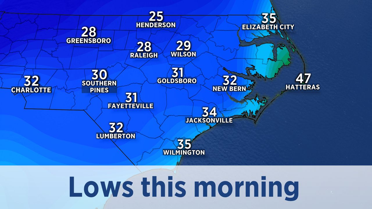
High pressure over the New England states helped keep a steady northerly flow across central North Carolina overnight allowing temperature to drop below freezing for a few hours. The northerly winds will let up during the day, but the cold air is in place and despite full sunshine we’ll see highs only in the upper 40s to mid 50s.
Not as cold tonight, but still around freezing for some of us, as skies clouds up a bit. Then Sunday will bring increasing clouds as a system approaches from the west. Expect a warmer day with highs ranging through the mid 50s to near 60 in the Sandhills.
Cloudy with a chance of showers late Sunday night into early Monday morning, a few showers may linger for the Monday morning commute, but expect decreasing clouds through the day.
The rest of the week is looking dry, as of now, with temperatures returning to normal by the end of the week.