


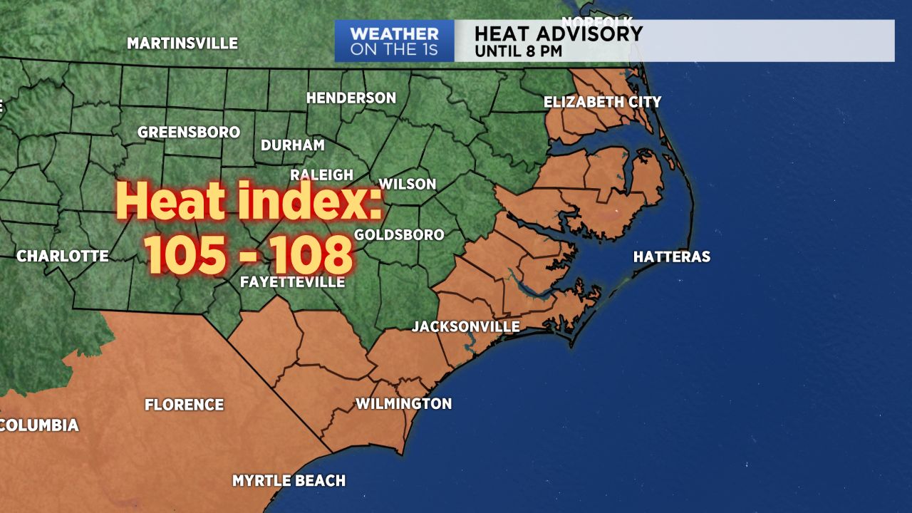
WILMINGTON, N.C. -- A Heat Advisory will remain in effect for much of eastern North Carolina until 8 tonight. The advisory is due to the possibility of the heat index or “feels-like temperature” reaching dangerous levels in the triple digits.
- The Storm Predication Center placed much of central and east North Carolina under a low chance for strong and severe storms
- A weak cold front will dive south into the state late tonight
- We’ll enjoy a brief cool down as high pressure makes it presence known in the area late Tuesday through Wednesday
The Storm Predication Center placed much of central and east North Carolina under a low chance for strong and severe storms. Most of the day will be dry and sunny as cloud cover takes it time growing in overhead.
After 2 p.m., we’ll begin to see storms blossom on radar and track east. It’s likely that the most aggressive storm activity will occur along and east of the I-95 corridor beginning late this afternoon.
One or two storms may be severe. Main concerns with any severe storms that develop with be strong wind gusts and small hail.
A weak cold front will dive south into the state late tonight and stall over southern portions of the state Monday before full, pushing through early Tuesday.
This front will likely cause scattered to numerous showers and storms late Monday. Showers and storm activity will spill over into Tuesday as the front stalls over South Carolina.
We’ll enjoy a brief cool down as high pressure makes it presence known in the area late Tuesday through Wednesday. During this time we’ll be mostly dry across most of the state with seasonable temperatures in the mid to upper 80s.