


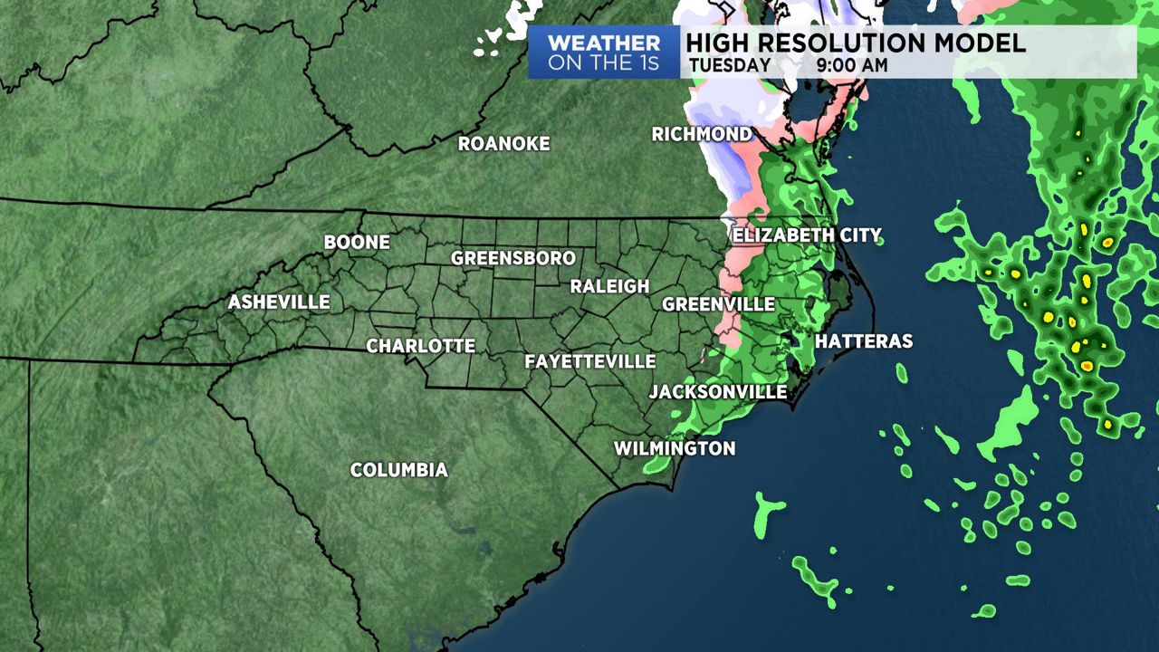
We wrapped up the weekend and started the new week with clouds and showers, and before we see all precipitation chances come to an end, some of us my see a few snowflakes on Tuesday morning...
As one system moves off the coast, the second system will move through the state early Tuesday. With moisture available, the front will trigger some light precipitation as it moves through. The best chance for seeing any snow will be from the Triangle, north and east. With only a quick burst of snow expected, along with mild ground temperatures, we do not anticipate any accumulations, other than on some elevated surfaces. Travel should not be impacted during the morning commute, however, we may see wet roads in some areas.
Skies clear by the afternoon as colder air builds into the area and it will turn windy.
As the high settles over North Carolina on Tuesday night, we'll see colder overnight lows into Wednesday morning.
With this high moving off the coast, we will see a one day warm-up on Thursday before our next chance of rain on Friday.
Watch Spectrum News for your latest local weather forecast.
Get the latest news, sports and weather delivered straight to your inbox. Click here to sign up for email and text alerts.